Thursday, October 28, 2010

Reducing the Environmental Footprint of Natural Gas Development Workshop in Vernal, UT

CNHP botanists Bernadette Kuhn and Peggy Lyon participated in a recent workshop titled "Opportunities and Obstacles to Reducing the Environmental Footprint of Natural Gas Development in the Uintah Basin." Seventeen globally imperiled plant species occur within areas undergoing heavy oil and gas development in Colorado (Colorado Rare Plant Conservation Initiative). With this in mind, we were interested in hearing about recent innovations that might minimize impacts to rare plants.

Lesquerella congesta
Lesquerella congesta (Dudley Bluffs bladderpod), about the size of a half dollar, is restricted to Green River Shale.  This formation contains the largest oil shale deposits in the world.

The workshop was held in Vernal, Utah, a town whose economy is largely based on oil and gas development. In 2010, the Vernal BLM office, just west of the Colorado state line, received requests for 528 Applications for Permits to Drill (APD) in Uintah County alone (Utah Division of Oil, Gas and Mining). This year drilling operations have begun at 378 new wells. Next door, in Rio Blanco County, CO, 658 APDs have been approved this year, with 98 permits still pending (Colorado Oil and Gas Commission). This area of the country, which includes northeastern Utah, northwest Colorado, and southwest Wyoming, has recently been experiencing a boom in oil and gas development.

Here are a few highlights from the workshop:

Utah State University professor Douglas Jackson-Smith shared results from his sociological study in the Uintah Basin. Jackson-Smith interviewed stakeholders involved in the permitting process, and presented excerpts from these interviews. Those excerpts illustrated the frustrations behind the permitting process that are felt by all stakeholders.

The Environmentally Friendly Drilling Program was introduced by Texas A&M researcher David Burnett. The program tests and develops technologies that reduce the footprint (area of environmental impact) of oil and gas activities. They host a "Disappearing Roads Competition" for university students every year, with the winner taking home $10,000. Several other speakers from the industry touted innovations that reduced water use, cut down on traffic to drilling sites, and reduced the need for new road construction.

Penstemon fremontii glabrescens and pipeline
A rare plant, Penstemon fremontii var. glabrescens (Fremont's beardtongue), sports small blue flowers in the foreground. The population is bisected by the pipeline in the center of the photo. This photo was taken in the Piceance Basin (Rio Blanco County, CO) on June 9, 2010.

Duane Zavadil from the Bill Barrett Corporation spoke about a new approach to compliance with National Environmental Policy Act (NEPA) regulations that the company piloted in the Nine Mile Canyon area of Utah. The Denver-based company reached agreements with the Southern Utah Wilderness Alliance on a drilling plan. The resulting pact was then signed by the BLM. The initial proposal called for 538 well pads. The final plan includes 120 pads.

The Intermountain Oil and Gas BMP Project is a new website hosted by the Natural Resources Law Center at the University of Colorado Law School. The website houses a free, searchable Best Management Practices (BMP) database. The database includes both mandatory and voluntary BMPs recommended for responsible resource management in the Intermountain West, including some written by the Colorado Rare Plant Conservation Initiative.

While innovations that reduce impacts to the landscape can help conserve rare plant populations, the impact of energy development on rare plants is not well understood and the effectiveness of many recommendations is unknown. Research and monitoring studies of rare plant populations are the only way to fill these knowledge gaps.

Tuesday, October 26, 2010

Field Work Realities

By Hannah Varani, CNHP Wetland Ecology Field Technician


For the past two summers, I’ve been working with CNHP Wetland Ecologist Joanna Lemly on a project known in our office as REMAP. Contrary to what you might think from the name, this is not one of our wetland mapping projects. It is a collaborative project between the Natural Heritage Programs of Colorado, Montana and Wyoming that is funded through EPA's Regional Environmental Monitoring and Assessment Program (hence, REMAP). The goals of the project are to 1) develop a standardized approach to assessing wetland condition across the Rocky Mountains and 2) establish baseline data of "un-impacted" wetlands or wetlands as they naturally occur in the absence of human impact. The Natural Heritage Programs and EPA will use this data to further refine field protocols for future wetland assessment projects. They will also use this data to compare with data gathered on "impacted" wetlands.


Now that's a fine first paragraph don't you think? So much information packed into each short(ish) sentence. It took me just a few minutes and some finger flexing to condense the work of so many people and countless hours into a handful of words. This parallels my experiences with the project. Let's take, for example, this past summer.

After many months of planning, my field partner, Kat Sever, and I were ready to start gathering field data in sites all over Colorado. On paper, our days looked like they would be similar to each other. They read like this: drive to a site, sample the site, camp, then drive to the next site, and repeat. In retrospect, you could say that this is a concise summarization of the reality. Yes, this is what we did… but to me, like the first paragraph, it feels so glossy. Let me elucidate the steps.

Driving to the site

First, this included packing the car. All summer, we drove a rented, white Ford explorer with Utah plates. We nick-named her "Starlene" and imagined her as a rhinestone cowgirl type: luxurious with working air conditioning but rough enough for the roads we were going to be accessing… barely. Half of the back space was already claimed by necessary field gear, books and maps. Over the course of the summer, Kat and I became adept at jigsawing all our food, camping gear, day packs, personal items, and any duplicate items necessary for the two weeks (or longer) we planned to be out. We had a system of organization that would completely deteriorate into complete bedlam by the second week nearly every time. Inevitably stopping along the way to pick up forgotten items in towns that had stores, we would begin the 2-8 hour drive to our site. Struggling with the map and directions typically only became a focused activity as we got closer to each spot. Have you ever noticed that while many dirt roads are signed, their signs often don't match the labels on your map? Have you ever noticed that there are roads where there is no business for a road to be and is that a pothole there in the middle of the road or just an early grave?!

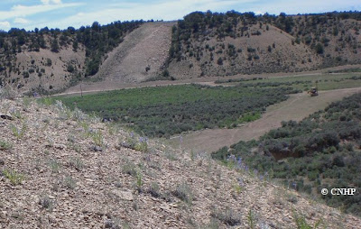
Eventually, Starlene would get parked and Kat and I would either set up camp or get ready to continue on to the site. In most cases it turns out that "un-impacted" sites, like the ones we were looking for, tended to occur in hard to access areas (surprise!). But even miles into the backcountry, we would still find evidence that people had been there before us.


This meant that we had to backpack into the majority of them. It also meant most of them included some travel off trail. Picture burned areas with downed logs in every direction, picture rows of sheer cliffs directly in the path, picture the Rocky Mountains in all their steep steepness. Reaching our final destination meant sweating. Profusely. Picture blisters and back sprains.


This is us: after just a few miles we feel as if we've been beaten and are ready to stop but we’re just not quite there yet. By this point we had a mantra: "just a little further, a few more miles to go." The expression on our faces: pure enthusiasm.

Sampling the site

Inevitably we would arrive at the spot where we would gather the data. I think a picture is the only way to really capture the labor spent maneuvering around our 1/2 hectare sample sites.


Yeah, I'll need to forge a path through this to do what I signed up for.


This is what that looks like: nobody said it would be pretty.

It would be exaggerating to say that every site was covered in shrubbery like this one, some were much more open.


Regardless, by the end of the summer Kat and I were pleasantly surprised that neither of us had broken an ankle. But I came to the following conclusions: invisible sinkholes are a common hazard in wetland work, as are wet shoes and stinky feet (especially in small, enclosed, shared spaces such as tents).


Alpine thunder and hailstorms are kind of fun, but also definitely a hazard. Don’t forget the Rite in the Rain® paper.

Camping

Data collected, shoes soaked, we were now prepared to spend our "ample" free time camping (and pressing plants, and identifying anything we had the stamina for). What can I say about camping that hasn't been said before? Especially in backpacking situations, it seems that most of the time, you hurt, are stinky, getting rained on or burning in the blazing hot sun, and constantly being dined on by various types of bugs - on the neck, on the hands, on the cheeks and of course, on the forehead. Now think about eating meals after sampling soils and the appeal of eating with fingers and nails all ringed in black.


Think about identifying plants in the dark cozy confines of the tent that you share with your coworker because, let's face it, it takes a special woman to carry both a full sized shovel and her own tent into the backcountry.


This is me eating dinner sans utensils. I'm happy that the pot hadn't gotten knocked over that night, that I was eating, and that it wasn't "twig surprise".

So now that we'd driven, sampled, and camped, picture leaving: packing up, packing out and throwing our wet gear into the back of a closet on wheels, squeezing into that disaster area, and heading out. By this time, I'm annoyed at Kat, she is thinking about murder, and the toilet paper is lost somewhere in the jumble. When we stop in small towns along the way, wide-eyed children back away from us and adults rummage in their pockets for change. Great! Halfway done! Just a few more sites and then we'd head home to a break that was never long enough.

Then Repeat

The break would include laundry, shopping, data drop-off, showering, relaxing, not camping. It would include remembering the previous weeks, the grimacing and sweating, our skin discoloring for one reason or another. Could we, would we, do it all again the next week?


Gladly!

Thursday, October 21, 2010

2010 North Platte Wetland Assessment - A day in the life of the field crew, Part 2

In Part 1 on Tuesday, we introduced the field crew and described the efforts required just to get us to the worksite.

Down to Work


When we finally arrived at a target wetland, we took photos of a 0.5 hectare circle around the random (and virtual) GPS "point".

A selection of wetland site photos.

Then, we laid out a 20x50m vegetation plot to record detailed data about wetland plant species and soils. Admittedly, some of the landowners who graciously to let us survey the wetlands on their land thought it was strange to watch us play with dirt and jump-ropes (a.k.a. 100m measuring tapes).

Erick and Lauren "jumping-rope".

Jenny digging holes.

Nina playing with dirt.

Then we assumed the proper botanist position (hunched over, hats up) and identified plants.

Erick and Eric checking out the Salix (willow) species up close.

Erick and Laurie keying out an Alsinaceae.

The Locals

Now, while most landowners were more than kind, we have to admit that it can be a little intimidating surveying wetlands on another person's land. Sometimes we needed a leap of faith to go for it, like the time we passed this sign before joining a landowner for lunch. (We took the photo in case we didn't make it back out.)

Not only did we make it, but lunch was delicious.

People weren't the only denizens to mention. Wetlands are known for their fantastic wildlife habitat, and here are some common companions in the field:


Ok, so the one on the bottome right isn't an animal. It was the spring mud-monster that surprised us when we were least expecting it and ate our legs if we stepped down too quickly. Luckily, we usually had a teammate nearby, ready to pry us out. A sure sign of groundwater-fed habitat for the other-worldly.

Trekking poles – apparently a preferred marmot snack. Marmots are surprisingly sneaky.

The Atmosphere

Aside from keeping the peace with wildlife and mud monsters, the largest threat to completing the day's survey rested on the weather. And we saw a lot of it – but usually we tried to protect the camera and throw down the soil auger (a.k.a. lightening rod) by the time the earth shaking crack of thunder was directly on top of us. So here are a couple of pre- and post-storm shots. We have been told that the 2010 Colorado summer was a dry one, but that is pretty hard to believe from our vantage point.

Here they come.

Post-diluvian drying methods: in field...

 ...vs. in field house.

Wrapping Up

At the end of the day, we can't say it was all work and no play. Other uses for rubber boots and waders – exceptional fly-fishing in the North Platte River Basin.

Lauren and Nina taking advantage of the Big Creek Lakes after work.

When all is said and done and despite the odds of nature, we had a fantastic summer of hard work and we got some great wetland data in the process.

Tuesday, October 19, 2010

2010 North Platte Wetland Assessment - A day in the life of the field crew, Part 1

By Laurie Gilligan, CNHP Wetland Ecologist

CNHP does much more than track rare species and ecological communities. Part of knowing what is special in the natural world is documenting what is out there to begin with, and that process inevitably leads to some adventures. During the summer of 2010, CNHP conducted year 2 of our basinwide wetland profile of the North Platte River Basin.

A wetland early in the season on the Arapaho National Wildlife Refuge.

Using GIS and statistical tools, 100 target wetland sites were randomly selected from digital National Wetlands Inventory maps of the basin. XY coordinates of each target site were uploaded into a handheld GPS and the field crew was tasked with heading into the field to survey each one. In three short months, we succeeded! The nature of random points is that they fall on both public and private land and anywhere within the basin from the dense riparian floodplains of North Park up to alpine fens in melting mountainous headwaters. These surveys will be used to gain a better sense of what types of wetlands are in the basin, what condition they are in, and what types of wildlife habitat they support.

Here is a behind-the-scenes look of a day in the life of these wetland surveys. Not all trails lead to the magical GPS points, so our crew got to see the real deal – and we did it right, with high field fashion, no pain no gain, and a humble respect for spring swamp monsters and lightening. But of course, when it's just you and a teammate at a 10,000-foot elevation wetland that you scaled miles of boulder fields to get to, and it's far past the snowmelt season, yet the sedges and spikerushes are still glistening and seemingly moving because of abundant flowing groundwater reaching the surface and held in place by meters of organic material that deposited in saturated conditions over hundreds of years or more - you realize that life is pretty good, and there is a lot to discover. Ready to get your boots wet?

Introductions

Introducing the North Platte field crew, plus a couple of other smiling faces. From left to right: Nina Hill (birder guru); Marin Chambers (helpful volunteer); Erick Carlson, a.k.a. "Erick with a 'k'" (field tech and GIS expert directly from CSU); Joanna Lemly (project PI), who we all owe a big hug for a paycheck and sweet summer job; Lauren Alleman (Louisiana mangrove expert extraordinaire); Laurie Gilligan (North Platte crew lead); Kat Sever (on CNHP's 2010 REMAP crew, see next week's blog); and Nick Spackman (visiting from Wyoming for wetlands training). And of course, where there were wetlands in North Park, there were cows, so they also deserve a nod for participation.

It should be noted that Joanna rocks - we (the crew) know she's awesome, and she KNOWS her wetlands! Here she is unloading her huge brain at the field house for training. Nina (on the left) is showing off the field manual that Joanna created. On the right behind Kat is Hannah Varani, also on the 2010 REMAP crew.

Two additional wetlanders joined the crew a couple of weeks after all the training session photo ops:

Jenny Howard, who dove right into her first backpacking trip ever at 11,000 feet, only a couple of weeks after spending 9 months at sea level studying brown tree snakes in Guam. Here she is sporting a huge pack weighing half of her bodyweight with 9 days worth of food and gear. She took on hail storms and high-elevation wetlands at record speed with a big smile. She doesn't mess around.

Eric Scott, who came to us from Illinois where he studied the genus Ipomopsis and who fearlessly keys grasses (a much-appreciated trait even by the most seasoned botanists). He is also known for his high-end field fashion sense with live accessories (note giant dragonfly on his hat).

Setting the Scene

Starting off a day in the field, the crew needed to get to the wetlands. So we often took a nice big hike. Glorious views, boulder-fields, scaling rocky outcroppings and waterfalls along alpine lakes, and some sweat and tears. Not bad for the start of the day, eh?


Can you find the field technicians in these photos?

Even when there was a trail or road leading the way, there were other hazards. A lot of wetlands we sampled were created and sustained by beavers – the best ecosystem engineers. And we were prepared to use their tricks of the trade.

A nice beaver created wetland.

A ditched out road is no match for wetland scientists and their rig. After this field session, we decided to get 4WD.

Stay tuned for Part 2 on Thursday, when we actually get some work done!

Thursday, October 14, 2010

Protecting the Dolores River skeleton plant

Note - Jude Sirota, Mesa County Weed and Pest Inspector, sent us this update on how she and her contractors have modified their weed control procedures to accommodate rare plants in the area. Thank you Jude, we really appreciate it!

By Jude Sirota
Weed and Pest Inspector, Mesa County Division of Pest Management

Two lonely dirt roads parallel the Dolores River north of Gateway, Colorado. Along these two roads a rare native plant grows, Dolores River skeleton plant (Lygodesmia doloresensis). It somehow persists in the face of road maintenance — blading, erosion and routine maintenance — and it grows alongside a state-listed noxious weed and growing menace, Russian knapweed (Acroptilon repens).

Lygodesmia doloresensis
Dolores River skeleton plant (Lygodesmia doloresensis). Photo by Peggy Lyon.

While on a tour of the area with the Nature Conservancy and the Colorado Natural Heritage Program, I learned about this scraggly, delicate, yet durable native. I was disheartened to see it growing within 6 inches of invasive knapweed plants, which I was responsible for treating on county roads. I promised Susan, Peggy, and Betsy that I would do my best to prevent the demise of their beloved plant.

The county contractor was due to spray the roads for knapweed in mid September and had been warned that there was a rare plant in the area. On September 9th Casey Holman, a seasonal crew member, and I traveled to Gateway with spray and garbage bags in hand. We drove up and down the dusty back roads until we found a skeleton plant. If there was knapweed growing within 30 feet of the native, we gently wrapped the Lygodesmia in a plastic garbage bag, all the way down to the soil, secured the bag with rocks, and treated the nearby knapweed with an herbicide. After uncovering the Lygodesmia, we placed orange flags with a big black "R" on them up and down the road from the patch so that the contractor would know to avoid spraying those patches.

On the drive back to the office, we felt good knowing we had done our part to protect a rare native plant. It was somewhat painstaking and may have seemed ridiculous to a passer-by, but I’m confident that our efforts will eradicate the knapweed (at least in a local sense) and reduced the threat to the native plants.

Tuesday, October 12, 2010

Center for Native Ecosystem's Mile High Bash

On Friday, the Center for Native Ecosystems (CNE) hosted their annual fundraising event, the Mile High Bash, held at Invesco Field in Denver. CNHP Director and Chief Scientist, Dave Anderson, and his family attended the event. Since CNE started in 1999, CNHP has worked with their staff on endangered species science, climate change, wildlife corridors, and other priorities that we share. Congratulations to CNE for 10 successful years!

This year's keynote speaker was Joel Sartore, a renowned photographer with National Geographic. The focus of much of his work has been photography of rare species, with the goal of increasing public awareness about the ongoing extinction event caused by humans. Joel's presentation included numerous photos from his new book- "Rare- Portraits of America's Endangered Species," which features striking photos of many vanishing and vanished species. Joel's website tells more about the book and includes a fun video promoting the book.

 Dave Anderson and his daughters meet author Joel Sartore. Photo by Keith Anderson.

Thursday, October 7, 2010

Calling all photographers...

The Colorado Natural Heritage Program is developing a Field Guide to Colorado's Wetland Plants and we need your photos!

The guide will include up to 500 species and is funded by an EPA Wetland Program Development Grant. If you can donate high resolution photos of wetland plants, we will credit you as the photographer, and you will receive a copy of the field guide!

For contact information and to download the list of species, go here.

Tuesday, October 5, 2010

Teller for Tomorrow forum October 16

CNHP ecologists Denise Culver and Allison Shaw will be giving a presentation about their recent survey of critical biological resources in Teller County at the Teller for Tomorrow forum. Hosted by the Rural Land Preservation Group in Teller County, this free, half day forum will be held at the John Wesley Ranch Retreat Center at 21285 State Highway 67, on Saturday, October 16. For more information about the forum, see the flier for the event (pdf).

Take advantage of this free opportunity to learn how you can help protect native habitats, preserve working ranches and farms, and safeguard the vistas that make Teller County special. And while you are there, take a moment to say hello to Denise and Allison and ask them about their work in Teller County and the Colorado Natural Heritage Program. We hope to see you there!