The floodplain of the Rio Grande in the San Luis Valley, with Blanca Peak in the distance.
The San Luis Valley
Although much of the San Luis Valley floor is devoted to irrigated agriculture, the eastern portion is still dominated by native vegetation. The northern end of the San Luis Valley has no natural hydrological connection to the southern end, which is drained by the Rio Grande River and its tributaries. This “closed basin” is home to the Great Sand Dunes National Park and Preserve, where the dune field and the surrounding sandsheet shrublands and sabkha wetlands form a sparsely vegetated landscape along the eastern edge of the valley.
Medano Creek flowing along the edge of the dunes, where it disappears into the sand.
The dune field, with the Sangre de Cristo Mountains in the background.
A rolling dune gathers no moss (or other vegetation), but parts of the Great Sand Dunes have stayed still long enough to become partially vegetated. Here we see a view of the sandsheet shrublands, west of the dune field.
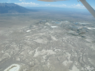
Sabkha wetlands at the "sump" - the bottom end of the closed basin.
Semi-desert shrub-steppe and the San Luis Hills.
Stay tuned for more in part 2 - when we fly over the southern Sangre de Cristo Mountains.


No comments:
Post a Comment
Thanks for your comment!
Please note that all comments are moderated, so there may be a delay of some hours (especially over the weekend or at night Colorado time) before your comment shows up.