Thursday, April 29, 2010

Site profile: North St. Vrain, Boulder County

B2: Very High Biodiversity Significance

North Saint Vrain Potential Conservation Area

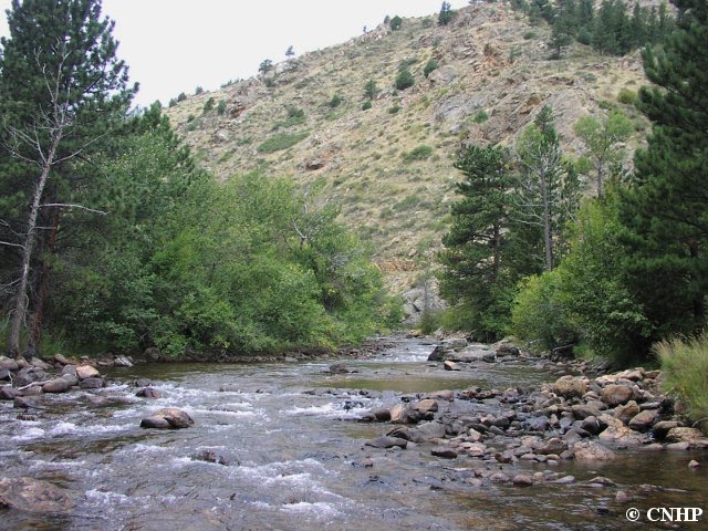
This site was visited in 2007 as part of the Boulder County Inventory. The North St. Vrain in northwestern Boulder County east of Allenspark is one of the few remaining roadless canyons along the Front Range. Here the North St. Vrain Creek and its tributaries have carved deep, narrow canyons through the granite outcrops. The surrounding slopes support an extensive mosaic of ponderosa pine forest, shrublands, grassland openings, and cliffs and rock outcrops above the riparian corridors.

The ridgelines and rocky outcrops of the North St. Vrain site support one of the largest known concentrations of the globally rare Larimer aletes (Aletes humilis) in the world. This species is narrowly endemic to Silver Plume granite in the montane zone of the Colorado Front Range, where it thrives in the shallow, gravelly surface soils around rock outcrops. Other important elements within the site include the globally vulnerable wavy-leaf stickleaf (Nuttallia sinuata) and the globally imperiled (G2/S2) Rocky Mountain cinquefoil (Potentilla rupincola). In addition, the site contains excellent examples of montane shrublands and grasslands, as well as riparian forest, shrublands, and willow carrs.

Aletes humilis habitat
 Aletes humilis (low-growing plants in foreground) in its favorite habitat.

Tuesday, April 27, 2010

Noxious weed monitoring at the U.S. Air Force Academy

Ecologist Renee Rondeau mapping weeds on the U.S. Air Force Academy

The US Air Force Academy ("the Academy") near Colorado Springs has established management objectives for weed control in order to remain compliant with state and local noxious weed regulations. Noxious weeds threaten the viability of rare and imperiled native species by competing for resources and actually altering the structure and function of the ecosystems they invade. Once noxious weeds become established in an area, restoration efforts become increasingly difficult and expensive.

The Academy contracted with CNHP in 2002 to survey and map noxious weeds to inform the development of an integrated weed management plan. We have performed additional monitoring surveys since then to provide the Academy with an indication of the effectiveness of their management plan and how it should be adjusted over time.

Our latest report on our weed monitoring efforts at the Academy is now available and includes a summary of the results of the past five years of population monitoring of targeted noxious weeds at the Academy, emphasizing changes that were observed between 2008 and 2009. In addition to field surveys, we also used our data to model suitable habitat and predicted rate of spread of one of the monitored weeds- spotted knapweed (Centaurea maculosa), an aggressive weed that has been spreading quickly- to give the Academy decision support tools to help manage this weed.


Spotted knapweed (Centaurea maculosa) suitable habitat probability (top) and predicted spread over time (bottom) at the Academy.  Analyses by Karin Decker and Michelle Fink. Click on images for larger versions.

Thursday, April 22, 2010

Field techniques - Getting there

During the field season, from about May through September, CNHP ecologists, botanists, and zoologists are racking up the miles, traveling to sites all over Colorado. Here is a typical commute, and some tips on what to expect:

First, the morning rush hour-
When is a cow not a cow? When it is a road hog! (ba-dum-bump)

Plan for delays-
A spare tire is your best friend. Plus, any day you don't go over a cliff is a good day indeed.

Stay on designated roads, even if those roads are, well, mud-
"I know I have a car-wash coupon around here somewhere."

Once out of the car, remember to take all the necessary gear with you, because you don't want to have to go back-
"Are we there yet?"

What the field office lacks in amenities, it makes up for in fresh air and sunshine-
...and bugs and wind and, oh look, it's those cows again.

Tuesday, April 20, 2010

Wetland Mapping Technicians - 3 to 4 new job openings

Update 5/27/2010 - Unfortunately the funding for these positions has fallen through. Please check our website regularly for the most up to date job offerings. Older blog posts may not represent the most current situation.

We have seasonal job openings for 3 or 4 experienced GIS Analysts to work on wetland mapping in Colorado. The successful candidates will use automated and manual computer processing to convert existing hard-copy National Wetland Inventory (NWI) maps to digital spatial data. Additionally, a subset of the NWI maps will be updated using color infrared and true color aerial imagery and verified through field visits to selected sites.

Anticipated position timeframe is June-September, 2010.

Closing date is May 31, 2010. For more information about these positions and how to apply, please see the announcement on the Employment and Volunteering page of our website.

Thursday, April 15, 2010

Pawnee montane skipper 2009 survey report now available

Hesperia leonardus montana
 Hesperia leonardus montana (Pawnee montane skipper)

The Pawnee montane skipper (PMS) butterfly (Hesperia leonardus montana) is listed as threatened under the endangered species act. From 1996 to 2002, four separate wildfires in the South Platte River Valley burned a large portion of the historical habitat for the PMS butterfly. This project was established in 2002 to implement an annual monitoring program to document PMS habitat condition and trends of population abundance in both burned and unburned areas.

Hayman fire high intensity burn area
A high intesity burn area from 2002 after the Hayman Fire.

2009 was a wet year, with rainfall at or above the 100-year mean for four of the six months during the growing season (March to August). The increased rainfall resulted in an abundance of blooming Liatris punctata (prairie gayfeather, the primary nectar source for PMS adults) and Bouteloua gracilis (blue grama, the primary food for PMS catepillars).

Hesperia leonardus montana on Liatris punctata
A Pawnee montane skipper feeding on nectar from Liatris punctata flowers

Between 2002 and 2009, the general trend has been for increases and then stabilization in the counts of PMS per acre at the unburned and low severity burn sites while counts at the moderate-to-high severity burn sites have lagged behind. In 2009, 1.52 PMS per acre were counted at unburned transects, which is near the high count for the eight years of monitoring, but it is still only about 40% of the maximum PMS per acre of 3.6 recorded in 1986.

Results of this 7 year study suggest that PMS were eradicated from the moderate-to-high severity burn areas and as time passes, PMS populations surviving the fire in unburned and low severity burn areas have increased in size and are subsequently dispersing into the moderate-to-high severity burn areas of the fire. Viability of the PMS population may depend upon maintaining and increasing PMS populations in moderate-to-high severity burn areas.

For more information about this ongoing study, see the full report on the reports page of our website.

Tuesday, April 13, 2010

Site Profile: Mount Princeton, Chaffee County

B2: Very High Biodiversity Significance

Mount Princeton Potential Conservation Area

The site was visited in 2008 during the Chaffee County Inventory. With an elevation of 14,197 feet, Mount Princeton is one of over 50 Colorado summits known as "fourteeners", and is part of the southern extension of the Collegiate Peaks range in central Colorado. Together with neighboring Mount Shavano and Mount Antero, Mount Princeton has formed through erosion of a batholith (large igneous intrusion originating deep in the earth's crust) of middle Tertiary age (20-40 million years old).

krummholz pine
A krummholz bristlecone pine

The south-facing slopes of Mount Princeton support a good example of the bristlecone pine (Pinus aristata) forest that is found scattered throughout the Collegiate Peaks from 10,000-12,250 feet elevation, just below timberline, on moderate to steep slopes on south and east-facing aspects. The forest growing here is subject to difficult conditions, with desiccating winds, broadly fluctuating temperatures, and rocky soils. At the upper limit of the forest where conditions are harshest, trees grow in stunted "krummholz" form. Although they are only a few feet tall, these trees can be hundreds of years old.

Thursday, April 8, 2010

SE Colorado Canyonlands BioBlitz in June


CNHP will lead a BioBlitz in June in the canyonlands of southeast Colorado on a private ranch. A BioBlitz is an intensive 24-hour survey of all plant and animal species in an area. During our southeast Colorado inventory work over the last couple of years, we developed lasting, positive relationships with a number of private land owners in the area. One rancher has invited us back for a more in-depth survey of the canyonlands that occur on his property. Hopefully, the results of this intensive survey will lead to the development of a conservation plan for the property.

While CNHP has participated in other BioBlitzes in the past, this will be the first time that we have sponsored one, in partnership with the Denver Botanic Gardens. We already have about 30 researchers from various organizations and institutions lined up to participate, and we can't wait to get started and see what we find.

For more information, contact Renée Rondeau.

Tuesday, April 6, 2010

Teller County survey of critical biological resources

CNHP, in partnership with the Coalition for the Upper South Platte (CUSP) and Teller County, has been awarded a grant from the Environmental Protection Agency (EPA) to survey critical biological resources in Teller County this summer. In addition to the EPA grant, Teller County was also awarded a Conservation Excellence grant from Great Outdoors Colorado, which they will use to further fund the survey work.

CNHP biologists, zoologists, and ecologists will be conducting inventories of rare species, wetlands, and other natural communities throughout the county starting this June. Teller County is at the intersection of four watersheds: Upper South Platte River, South Platte River Headwaters, Fountain Creek, and Upper Arkansas River. CNHP has surveyed all counties surrounding Teller, and we are excited to finally get the chance to fill in this gap in biodivserity knowledge.


A kick-off meeting will be held April 21 at the Carter Herbarium of Colorado College in Colorado Springs, in order to get input from partners and other interested parties about where the best places are to concentrate our surveys and how we can best collaborate with partners from CUSP, the Carter Herbarium, and the Royal Gorge Field Office of the Bureau of Land Management.

Thursday, April 1, 2010

Closer to home

Endemic species are restricted to a particular geographic area. CNHP has documented occurrences for 166 Colorado endemics, that is, species or communities known only from the state of Colorado. This means that CNHP is the only natural heritage program collecting and maintaining data about its distribution and condition.

Penstemon harringtonii (G3S3) occurs in an area of about 4,000 square miles in the Colorado River drainage in northwestern Colorado.

A closely related species, Penstemon penlandii, (G1S1 and federally listed as Endangered) is known from an area of less than 10 square miles in northwestern Colorado.

Of course, in real life, plants and animals don't pay any attention to the rectangular state boundary. Many of our rare species overlap into neighboring states, and are perhaps better described as "narrowly restricted to a small geographic area." In these instances, while all relevant state natural heritage programs maintain data on the species, only one program will have "rank responsibility," assigning the global as well as state rank for this species.