Showing posts with label GIS. Show all posts

Wednesday, May 10, 2017

Human Disturbance in Colorado’s Potential Conservation Areas

by the ESS 440 Anthropogenic Disturbance Team

Throughout the spring 2017 semester at Colorado State, seniors in the ecosystem science program have been working through their senior project with the help of a local Colorado agency or organization. This blogpost is an overview of one of the team's collaboration with the Colorado Natural Heritage Program. For more information on the team and an overview of this project, please see our previous blog post, found here.


The Colorado Natural Heritage Program (CNHP) has worked in Colorado since 1979, cataloguing information about the rare and endangered species that exist within the state.  One aspect of their work has been the creation of potential conservation areas (PCAs) in Colorado. A PCA is an area created to denote some level of biodiversity significance. CNHP has identified these areas in the hopes of protecting the plants and animals that reside within it. The main objective of the following project is to build upon CNHP's work in order to better understand the level at which potential conservation areas (PCAs) in Colorado have been disturbed by human activities.

Map of Potential Conservation Areas
Location and rank of Colorado's potential conservation areas (PCAs)

The map above gives the location and rank of each PCA that has been identified by CNHP in Colorado. An area shown in pink, given the rank of B1, surrounds species that are deemed to have outstanding levels of biodiversity significance. These are highly important areas for conservation and contain Colorado's rarest or most imperiled species. Orange sites given a rank of B5 on the other hand, hold species of more general biodiversity significance, likely containing communities that are healthy and relatively abundant in the state.

This map helps focus conservation efforts by ranking areas of biodiversity significance that may be currently unprotected. Areas given a higher ranking such as B1 or B2, are higher priority for conservation. However, to add another layer of information to this idea, our team wanted to find how much anthropogenic, or human, disturbance has taken place in each of these areas.

The first thing the team did was use the location and rank information from each of Colorado's PCAs and combine it with a landscape disturbance index (LDI) dataset. The LDI dataset contains information about a type of disturbance that has been created and that disturbance type's severity level.
distance decay curves used in the LDI model.
Distance decay curves used to determine the disturbance range of each anthropogenic activity
(reproduced from Rondeau et al. 2011)

Above, you can see the distance decay curves that were used as part of the LDI dataset. Each curve is associated with one of the nine types of mappable anthropogenic disturbance. The curve assigns an impact weight, the amount of disturbance created, over a distance to each type of disturbance activity. Some activities have a further reaching effects than others. For example, low intensity urban development has an initial impact weight of 300, however it still creates some level of disturbance up to 2000 meters away. Agriculture on the other hand, also carries an initial impact weight of 300, but its furthest reaching effects end at 500 meters.
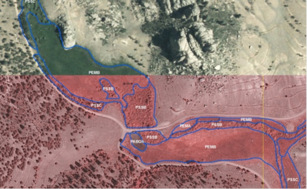
Anthropogenic disturbance in Colorado displayed on a color scale ranging from green to red (CNHP 2016). Green denotes undisturbed areas. Red denotes highly disturbed areas. The PCAs that were the focus of this study are highlighted in various colors.


In general, areas along the Front Range and the eastern plains of Colorado have experienced the greatest amounts of anthropogenic disturbance. This is due to the high population density along the Front Range and eastern Colorado's agricultural activity. From the Rocky Mountains westward, there are much lower level of disturbance in the state. A major factor of this is the ruggedness of the terrain. Mountain areas are less accessible to people and have lower population density. Many mountain areas may also currently have some level of protection surrounding them, such as a state or national forest.

Having this new information about the level of disturbance an area experiences, allows conservation efforts to be balanced. While a B1 area may have greater biodiversity significance than a B2 area, it is possible that the B2 area is experiencing a greater amount of anthropogenic disturbance and therefore may be considered a higher priority for conservation.

Through our analysis, we identified the most and least disturbed B1 PCAs in the state. In the above map, you can see an area in western Colorado highlighted in blue. This area is the Colorado River PCA. It is a B1 PCA and home to the endangered Colorado pikeminnow, humpback chub, and razorback sucker. It is the most disturbed B1 PCA in Colorado primarily due to its proximity to the I-70 urban corridor. Not addressed in the LDI are additional significant impacts, such as the large amount of agricultural water diversion used for irrigation. Water diversions use dams and canals to draw water out of the river.

In contrast, Colorado's Hankins Gulch, located in central Colorado and shown in pink, is the least disturbed B1 PCA in the state. The area has a minimum elevation of 8,305 ft., meaning the mountainous terrain puts this area out of reach for many activities and land uses. Additionally, motorized vehicle usage is also prohibited within the area, further reducing accessibility to the area for most people. Hankins Gulch receives its B1 PCA status because it is home to the critically imperiled budding monkeyflower (Mimulus gemmiparus).

While this was just one example of the scope at which human disturbance can affect a PCA, identifying areas in Colorado that are heavily disturbed by humans is an important step in prioritizing conservation efforts in order to most effectively protect Colorado's biodiversity. For more information, please follow this link to an interactive Story Map created about the project.

Special thanks to Michelle Fink and David Anderson of CNHP for their contributions and guidance with this project.
---
CNHP. 2016. Landscape Disturbance Index Layer for Colorado. Edition 12_2016. Raster digital data. Colorado Natural Heritage Program, Colorado State University, Fort Collins, CO.

Rondeau, R., K. Decker, J. Handwerk, J. Siemers, L. Grunau, and C. Pague. 2011. The state of Colorado's biodiversity 2011. Prepared for The Nature Conservancy. Colorado Natural Heritage Program, Colorado State University, Fort Collins, Colorado.

Monday, April 10, 2017

CSU Seniors Join CNHP to Address Anthropogenic Disturbances in Colorado

By George Simpson

Ecosystem Science and Sustainability is one of the majors offered through Colorado State’s Warner College of Natural Resources. The degree program teaches students how to better manage the Earth’s natural resources through the application of science in decision and policy making areas. After four years in the program, many students are finishing their final semester and preparing to graduate. For most, this means enrolment in the curriculum’s capstone class ESS 440. The distinguishing feature of the class is a semester long project working with a local agency. The projects are designed to allow students to apply the skills they have been carefully refining over the past four years in order to help practitioners solve a local sustainability problem. Student have multiple project choices to choose from, and thus are divided into smaller teams to work in throughout the semester.

Our team will be collaborating with the Colorado Natural Heritage Program (CNHP) throughout this semester. The Colorado Natural Heritage Program works with rare and imperiled species in Colorado, conducting research and sharing their expert information with stakeholders in order to help ensure that Colorado’s biodiversity is not diminished. CNHP has mapped over 1,800 Potential Conservation Areas (PCAs) in the state that contain species of biodiversity significance. Our team will be running an analysis of their PCAs to determine what areas in Colorado have experienced the greatest impacts from anthropogenic disturbances. This information will allow us to prioritize conservation efforts by combining knowledge about the biodiversity these areas contain, and the level of disturbance the area has experienced from anthropogenic activities. Included with this assessment, the team will create a summary of its findings to be shared with the general public.  

While a seemingly complex task such as this may appear daunting at first glance, 2017’s ESS 440 CNHP project team has fielded some real talent, fully qualified to complete the task at hand. Aspiring young scientists Julia, Alex, Daniel, Caden, Leo and George, working under the guidance of CNHP’s Michelle Fink and David Anderson, will use this semester to better understand the sources of anthropogenic disturbance in Colorado. The team’s composition has allowed us to blend technical expertise and creativity skills to best complete this project.


The ESS 440 project team from left to right: Leo, Caden, Danielle, George, Julia, and Alex.

Alex and Julia are the team's ArcGIS wizards. They cast virtual ArcGIS spells to extract, clip, interpolate, overlay and buffer CNHP’s data so that it can be grown into a map that tells the story of anthropogenic disturbance in Colorado. Their work will produce a map of Colorado depicting potential conservation areas in the state and the extent to which they are affected by a number human activities.

The next step in the team’s analysis will be to pick apart the results, identifying overlying trends and drivers of anthropogenic disturbances. Danielle and George will pore over the results, looking for spatial patterns and reoccurring themes between sites. The two will compile the team’s work into a digestible, easy readin’ scientific report that details the project’s goals, methods, results, and outcomes.

The team’s final members, Caden and Leo, are in charge of crafting the projects final piece, a summary of our work designed to be shared with the general public. They will shape the project's key points into an interactive story of the project that people can access to learn more about this project and the work that CNHP does.

As the semester winds down, stay tuned for our team’s completed project and access to our Storymap that you can use to learn about sources of anthropogenic disturbance that affect outdoor areas in Colorado near you.

Thursday, January 10, 2013

New CNHP employee: Jeremy Sueltenfuss

After receiving a bachelor’s degree from Colorado College, my wife and I moved to Venezuela for two years, where we both taught at an international private school.  Teaching middle and high school science was a great way to pass on my passion for the natural world to young eager minds.  After teaching for two years, we moved back to Colorado for me to complete a Master’s degree from Colorado State University.

Jeremy Sueltenfuss and his dog Elvis
Though most of my undergraduate research focused on the response of various wildlife communities to forest management, my interest in wetlands brought me to CSU to look at the impacts of irrigation in the west on wetland ecosystems.  Agricultural diversions have severely degraded the majority of western rivers, but leaky earthen canals transporting this water over large distances create a substantial amount of wetland area across our otherwise arid landscape.  After graduating in the summer of 2012 I worked on a wetland restoration project for the National Park Service.   Historic land use at Florissant Fossil Beds had channelized a wet meadow in the area.  We filled each of the channels and restored the natural hydrologic regime within the valley.  After this great experience CNHP hired me as a wetland ecologist and GIS specialist and I couldn't be happier!

Wednesday, January 2, 2013

NEW GEOSPATIAL DATASET ONLINE: Terrestrial Ecological System Patches


Terrestrial Ecological Systems are dynamic groupings of plant and/or animal communities that: 1) occur together on the landscape; and 2) are linked by similar ecological processes, underlying abiotic environmental factors, or gradients; and 3) form a readily identifiable unit on the ground (Comer et al. 2003). In order to assess the health of Colorado’s major ecosystems, CNHP developed a dataset of large-sized (>20,000 acres) ecological system patches for the “State of Colorado’s Biodiversity” project. Ecological systems were derived from the Southwest Regional Gap Analysis Project landcover dataset (USGS 2004).

Developing this dataset enabled CNHP to identify at-risk ecosystems in Colorado. Individual patches were ranked on a scale of 1-10 based on overall condition status, threat status and protection status. Top threats were assigned to each patch. The results of the analysis show that many of Colorado’s major ecosystems are intact, but only two are effectively conserved. Shortgrass prairie is by far the most altered ecological system. Nearly half of the shortgrass prairie in Colorado has been lost in the past century; however, several large, high quality areas still exist. While these data are an effective tool for broadly measuring current successes, they also highlight intact landscapes that pose great opportunities for future conservation efforts.


Table with Conservation Status Ranks of
Major Ecological Systems in Colorado
These data are bundled in an ESRI geodatabase and can be downloaded from CNHP’s website here.  As always, if you need more detailed information or need data for commercial use, please contact our Data Distribution Coordinator.

Wednesday, November 14, 2012

Mapped locations of rare and imperiled species and natural communities in CNHP’s database doubles in the past decade


CNHP strives to have the most comprehensive database of rare and imperiled plants, animals and unique natural communities (referred to as “elements of biodiversity” or “elements”) in Colorado. We compile data from our own field surveys and county inventories, and collect data from key partners and other professionals in the conservation community. It is nearly impossible to survey the entire state, but as a collective, we can build a comprehensive database that serves Colorado and ensures that the complex challenges of the 21st century are tackled thoughtfully and informatively.

See our latest tracking list here. If you have data for any species we track, please complete a CNHP field form and submit your data to our repository. You can download CNHP field forms or fill them out online at the CNHP data submission page.

Thanks to Colorado’s conservation community, our database has grown from 11,500 mapped locations of rare elements in 2000 to over 25,000 mapped locations in 2012. Help us double this again in the coming decade!

Graph of the number of rare and imperiled species and natural communities
that have been mapped by CNHP during the 2000 - 2012 period.

Tuesday, May 15, 2012

Species Modeling at BWB2012

By Gabrielle Smith, CNHP Wetland Mapping and GIS Specialist

This year’s NatureServe Biodiversity without Boundaries (BWB) conference took place in Portland, OR and we lucked out with a week of unusually sunny weather. The conference was a great opportunity to meet staff from other Natural Heritage programs and learn about their work. I attended sessions focused on mapping and modeling and learned a great deal. One of the early talks was on the subject of increasing modeling capacity at the various programs, and on that note, I went out to receive some training.

The highlight of the trip for me was an R training workshop held at the Oregon Biodiversity Information Center on the Portland State University Campus. The training was led by Emile Henderson of the Oregon Biodiversity Information Center and Tim Howard from the New York Natural Heritage Program. The workshop was focused on building species distribution models using the RandomForest ensemble classifier object in the statistical software package R.

R Project Logo, courtesy of http://www.r-project.org/
The R Project - Not just a letter of the alphabet anymore.

The basic concept of species distribution modeling is that you know locations where a species has been observed and you also know things about the environment at the locations where the species have been observed. If you have many species observations, and many range-wide GIS data layers that represent variables such as elevation, aspect, annual precipitation, soils, geology and many other variables, you can combine these pieces of information to create a profile of environmental variables that supports the species. Then you can look at other places, places the species has not been observed and say “do the environmental variables at this location match up to what I know about where this species likes to live?”

Ipomopsis globularis species distribution map
A CNHP created species distribution model for Ipomopsis globularis (globe gilia), a rare plant found only in the mountains of Colorado (click for larger version). The dots show the known occurrences of the species, the green shows the results of the model, suggesting other places to look for the species.


The output of the modeling process is a raster (cell-based) dataset that for each cell includes a probability of the species occurring in that cell location. The modeler can set a probability threshold so they can effectively say “show me every raster cell that has a 75% or greater chance of my species of interest occurring in that cell.” The resulting species distribution model can guide future field surveys of the species of interest or guide conservation planning action. Models are no substitute for on-the-ground field work and observations, but they can be a useful tool to guide fieldwork and discover the qualities that make habitat suitable for a species.

A long term goal of modeling all tracked species by all member programs emerged from this year’s BWB conference. A challenging goal to be sure, but one that I hope to help CNHP achieve!

Tuesday, April 17, 2012

New report: North Platte River Basin Wetland Condition Assessment

CNHP Wetland Ecologists recently completed work on a three year project assessing the condition of wetlands in the North Platte River Basin. The project was carried out collaboratively with Colorado Parks and Wildlife (CPW)’s Wetland Wildlife Conservation Program and with CPW GIS Analysts. The final report, "North Platte River Basin Wetland Profile and Condition Assessment," is now available on our Reports page.

The report summarizes findings for the four primary project objectives:
  1. Compiling existing spatial data on wetlands in the North Platte River Basin to develop a wetland profile;
  2. Conducting a statistically valid, field-based survey of wetland condition in the basin;
  3. Modeling the distribution of wetland condition throughout the basin using collected field data and additional spatial data on potential stressors; and
  4. Determining metrics to measuring key habitat features for priority waterfowl species.

To create the wetland profile, a wetlands had to be digitally mapped for the entire basin. At the outset of the project, National Wetland Inventory (NWI) data was available for less than 10% of the basin, so it was up to CPW and CNHP to map the rest. The completed dataset was used to summarize wetland acreage and type in a number of different ways. There are over 131,000 acres of wetlands in the North Platte Basin, with the majority (77%) being freshwater herbaceous wetlands, with shrub wetlands being the second most common (20%).

Mapped wetlands in the North Platte Basin. (click to enlarge)

To assess condition of wetlands in the basin, 95 randomly selected wetland sites were visited in the field and surveyed for 1) Landscape Context, 2) Biotic Condition, 3) Hydrologic condition, and 4) Physiochemical Condition. Scores were produced for each site visited and then extrapolated to estimate wetland condition of all non-irrigated wetland acres. A predictive model of wetland condition was also developed to predict the condition of wetlands not visited in the field. The results of this project provide a baseline assessment of wetland quantity and condition and will inform conservation and watershed protection.

Erick Carlson and Laurie Gilligan sampling wetlands for the project.

Condition of sampled sites was assessed using the Floristic Quality Assessment, Ecological Integrity Assessment (EIA), and Vegetation Index of Biotic Integrity methods. Extrapolated results indicate that 34% of all wetland acres in the basin would receive an overall EIA rank of A (excellent!), 48% would receive a B, and 17% would receive a C. Across all methods, trends clearly indicate that wetlands in the North Platte River Basin are overall still in very good condition.

Ecological Integrity Assessment scores applied to wetlands across the basin.

A statewide Level 1 GIS-based Landscape Integrity Model for wetlands was applied to the North Platte River Basin. Results from the model show that although only 10% of the total basin area falls within the severe stress category, 27% of the wetland acres fall within the severe stress category and an additional 50% fall within the high stress category. Higher stress wetlands are located in the valleys where human activities have altered the landscape.

Wetland Landscape Integrity model.
Areas of anthropogenic stress (red) correlate well to EIA scores < A.
Habitat features potentially important to waterfowl were identified by CPW Avian Biologists and a crosswalk between the habitat features and NWI codes was developed. Based on this crosswalk, almost all (90%) of the wetlands in the basin are types important to waterfowl.

Tuesday, March 20, 2012

Job Opening: Weed Mapping Technicians

We have seasonal job openings for up to 6 experienced field mapping technicians to map noxious weed species at the U.S. Air Force Academy and Farish Recreation Area in El Paso County, Colorado.

This position requires field botany and basic GIS skills. The successful candidates will be able to use dichotomous keys or field guides to correctly identify weed species, and have the necessary technical skills to use GPS and ESRI’s ArcPad and ArcGIS software to accurately map and attribute infestations. Field work will be performed independently, and you must provide your own transportation daily to the work location. A computer station will be provided at the Air Force Academy for daily data download and processing.

Work duration will be approximately from April through September, 2012. First consideration of applicants will begin April 2, 2012. Applications will be accepted until all positions are filled. For more information on the position and how to apply, see the full announcement on our Employment and Volunteering page.

Friday, March 9, 2012

Colorado Wetland Mapping - Then and Now

by Gabrielle Smith, CNHP Wetland Mapping and GIS Specialist

In the 1970’s the US Fish and Wildlife Service started a wetland mapping program called the National Wetlands Inventory (NWI) , with the goal of mapping the entire country’s wetland resource. Using the Cowardin system of classification, most of the country was mapped from approximately 1975 to 1985 by people looking at aerial photos through stereoscopes and drawing the wetland outlines with markers on sheets of transparent plastic. This original mapping was at resolutions ranging from 1:24,000 to 1:50,000. Over the course of the following decades, individual states have scanned these data into image files that can be viewed on a computer screen, and many have produced updated data building upon the same basic methodology. However, only recently has true digital wetland mapping really taken off.

CNHP first began working on statewide wetland data in 2008, in partnership with Colorado Parks and Wildlife (CPW). At that time, there was very little digital mapping available:


All of the data represented by blue in the above map were scanned images – useful for site-specific exploration, but not usable for analysis. CNHP and CPW have worked with a variety of partners (U.S. Environmental Protection Agency, U.S. Forest Service, Bureau of Land Management, local governments, and others) to digitize and update the 1970’s era scans and increase Colorado’s capacity to make informed decisions regarding wetlands. Now, due largely to CNHP and CPW's efforts, the statewide wetland mapping status map for 2012 looks like this:

Making informed decisions about Colorado’s wetlands has critical implications for Colorado’s biodiversity: while it is estimated that only about 2% of the land area of Colorado is wetland, that 2% of the state supports over 40 vertebrate species of concern:

Species of concern in relation to habitat prevalence.

Modern Geographic Information Systems (GIS) allow wetland mappers to improve upon the original NWI data. By using a variety of data sources and improved resolution National Agriculture Imagery Program (NAIP) true color and infrared aerial photos, wetland mappers can delineate wetlands at much finer resolutions and higher ground-verifiable accuracy. Wetlands mapped to the 2009 time period are typically mapped at 1:3,000 to 1:10,000 resolutions.

The following images show infrared / true color examples of some Colorado wetlands in Park County.

Beaver Pond Complex at high altitudes, with ponds surrounded by saturated shrubs.

Two fens: PEMB stands for Palustrine Emergent Saturated wetland.

Alkaline playas: these wetlands are ephemeral and may go several years without a flood event. PUSCh stands for Palustrine Unconsolidated Shore Seasonally Flooded Impounded.

Tuesday, January 24, 2012

And the Wetland Mapping Continues...

by Erick Carlson

The Colorado Natural Heritage Program has been active in generating wetlands maps for the state of Colorado for several years. The wetland ecologists and GIS mapping technicians team up to produce the best quality maps, for the largest area possible, as fast as we can. Colorado lags behind other western states in the amount of the state with wetland maps available in a digital (GIS) environment. The entire state of Colorado was initially mapped in the late 1970’s/early 1980’s when the National Wetlands Inventory program was initiated by the U.S Fish and Wildlife Service. The original effort produced paper maps with wetland boundaries and information about the type of wetland. Unfortunately, this is about as far as they got for several decades. As computerized mapping software became a daily tool used by natural resource planning professionals, it became necessary to take those paper maps and make them digital. As we began the process of converting the maps to digital files, it became apparent that much of the landscape had changed in the previous 30+ years. While a straight conversion from paper to digital is cheap and fast, working on updating the wetlands boundaries takes much longer.

The cost and time associated with creating new wetland maps requires a more focused approach on a project by project basis, as the need and funds arise. Our most recent effort focused on Park County, Colorado. The South Platte River headwaters are located here as well as some unique saline flats and large high elevation fen complexes. Above is a map showing the extent of the project area and the extent of wetlands on the landscape.

To create a new wetland map, the mapping technicians look at several pieces of information to decide where a wetland exists and what type it is. The characteristics considered include the cover type (forest, herbs, sand, open water), the frequency of flooding (temporarily, permanently, seasonally) and if there are any modifications made by humans (canals, dams). For the Park County project area aerial photographs from the summer of 2009 and 2005 were viewed:

Summer 2005 on the left and summer 2009 on the right.


Possible fen identified on topographic map.


We also use the original effort from the NWI as the information can still be relevant. This can be especially helpful when deciding how often a wetland is likely to be flooded. 

Original NWI mapping example.

Project numbers so far:
The total number of individual wetland polygons created – 23,788
The total acres of wetlands delineated – 69,914.7
The number of USGS 1:24,000 quadrangles mapped - 37

And now some pictures from field visits to sites to verify that what we were seeing on the aerial photographs matched what was on the ground. There were some tricky photo signatures that needed to be checked.

First a saline wetland, very interesting, with limited plant species diversity as there was a ¼ to 1” layer of salt on the soil surface - tough conditions.

  
A shrubby riparian area, with lots of saturated spots was common in the higher elevations; and a close up of the mossy, sedgy, grassy under story.


The ever dynamic beaver created ponds were easy to spot from aerial photographs or when we were perched above them on roads.


Lots of water for irrigation this year for hay pastures.


Wetlands can be different sizes and shapes, just like horses. We saw these little (and big) fellas while cruising area looking for wetlands.


A big thanks to Gabrielle Smith for putting up with me in the car, forcing her to camp in the cold, rain and mosquito filled South Park area. She was silly enough to accompany me up there twice!


Wednesday, October 19, 2011

CNHP takes over maintenance of COMaP

The Colorado Ownership, Management, and Protection (COMaP) project was initiated by Dr. David Theobald, Associate Professor in the College of Natural Resources at Colorado State University (CSU). The goal of COMaP was to build a statewide protected areas map for Colorado from all of the disparate sources of land ownership and management data throughout the state. The first version of COMaP was released on May 28, 2004 as COMaP v1.

Annual updates and improvements to COMaP through version 8 have been funded by the Colorado Division of Wildlife and Great Outdoors Colorado (GOCO). In 2010, funding was provided via a USGS GAP Stewardship proposal to allow COMaP to become integrated with their national Protected Areas Database (PAD-US). At that time, responsibility for maintaining, updating, and distributing COMaP became a collaborative effort between CNHP and the CSU Geospatial Centroid.

Maintaining COMaP is a natural fit within CNHP's mission and, indeed, many other Natural Heritage Programs and Conservation Data Centers across the nation (all part of the Natural Heritage Network) are the state stewards for protected areas data.


With the funding from the PAD-US project, CNHP was able to update COMaP again, and version 9 is now available for download from CSU's Geospatial Centroid. This round of updates focused on state, regional, and local government lands in addition to GOCO funded conservation easements.

We would like to thank all of the agencies and organizations that submitted updates and corrections, your contributions have been essential to the success of this project!

Thursday, August 18, 2011

Data on website updated for 2011

The data that we have available for download and viewing on our website has been updated for 2011. This includes updated potential conservation area reports; downloadable GIS data for element lists by 7.5 minute quad, potential conservation areas, and network conservation areas; updated tracking lists; and an updated interactive map of where CNHP is working this year.

These datasets get updated annually and they are available for free for non-commercial purposes only. For more up-to-date, detailed, specific, and/or commercial use information please contact our Environmental Review Coordinator, Michael Menefee.

Monday, November 22, 2010

CNHP supplies spatial analysis training to sister program

We were visited last week by Andrea Hazelton, Botanist for the Navajo Natural Heritage Program, who came up to Colorado to receive training in Geographic Information Systems (GIS) spatial analysis techniques by CNHP Landscape Ecologist Michelle Fink.

The Navajo Natural Heritage Program (NNHP) is working in collaboration with The Nature Conservancy and CNHP to develop a Conservation Action Plan for the San Juan Basin, an area that covers the four-corners where Colorado, New Mexico, Arizona, and Utah meet. The Navajo Nation is the largest landowner of the San Juan Basin area.

Andrea spent an intensive four days with Michelle learning various techniques to model ecological integrity at the landscape scale, while gaining a healthy appreciation of all the things that can go wrong with GIS software (Michelle's Law: the tighter the timeline, the more things will go wrong).

The Navajo Nation (light pink) in relation to the San Juan Basin (blue outline).

Thursday, August 5, 2010

Data on website updated for 2010

The data that we have available for download and viewing on our website has been updated for 2010. This includes updated potential conservation area reports; downloadable GIS data for element lists by 7.5 minute quad, potential conservation areas, and network conservation areas; updated tracking lists; and an updated interactive map of where CNHP is working this year.

These datasets get updated annually and they are available for free for non-commercial purposes only. For more up-to-date, detailed, specific, and/or commercial use information please contact our Environmental Review Coordinator, Michael Menefee.

Thursday, June 17, 2010

Groundtruthing wetland mapping

As a part of our Setting Mitigation in the Watershed Context project, we are attempting to use aerial imagery to not only locate wetlands, but to classify them by type. Wetlands are frequently difficult to identify from a distance, and manual photo interpretation can be very time consuming. We hope to eventually use our manual photo interpretation results as training data for pattern recognition software. For our imagery, we are using National Agriculture Imagery Program (NAIP) digital aerial photos taken in 2009. The images are at 1 meter resolution and cover about 1,300 square miles of the Cache La Poudre, Big Thompson, and South Platte River watersheds in northern Colorado. The near infra-red color band of these photos is especially helpful in identifying wetlands, however, NAIP flight-lines are typically flown in the summer, when the leaves on deciduous trees can obscure what occurs underneath.

An example of NAIP near-infrared imagery overlaid with mapped wetlands
identified by type.

Because even the best photo interpreter can have false positives (identifying irrigated hayfields or stock ponds as wetlands), or false negatives (missing wetlands due to leaves obscuring the image), we have been groundtruthing several locations within the project area in order to help refine our search pattern.

One of the wetlands recently visited during groundtruthing.

CNHP GIS Analyst Zack Reams and Ecology Technician Ellen Heath recently went out on a groundtruthing excursion. Using their trusty GPS for navigation, they visited several tentative wetland signatures near urban areas. The first area they went to, east of the Centerra Mall in Windsor, turned out to be a stormwater catchment area and not an actual wetland, but they were able to confirm the remaining sites as actual wetlands.

Zack consulting a print-out of NAIP imagery to see if he's near
the wetland he's looking for. Photo by Ellen Heath.

Zack linked his collected GPS coordinates with the digital photos Ellen took at each site so that pictures of the visited areas can be stored with their spatial coordinates in a Geographic Information System as a part of the groundtruthing validation process.

Zack getting a GPS waypoint. (Ellen has the camera, so there aren't any pictures of her!)
Photo by Ellen Heath.

Tuesday, April 27, 2010

Noxious weed monitoring at the U.S. Air Force Academy

Ecologist Renee Rondeau mapping weeds on the U.S. Air Force Academy

The US Air Force Academy ("the Academy") near Colorado Springs has established management objectives for weed control in order to remain compliant with state and local noxious weed regulations. Noxious weeds threaten the viability of rare and imperiled native species by competing for resources and actually altering the structure and function of the ecosystems they invade. Once noxious weeds become established in an area, restoration efforts become increasingly difficult and expensive.

The Academy contracted with CNHP in 2002 to survey and map noxious weeds to inform the development of an integrated weed management plan. We have performed additional monitoring surveys since then to provide the Academy with an indication of the effectiveness of their management plan and how it should be adjusted over time.

Our latest report on our weed monitoring efforts at the Academy is now available and includes a summary of the results of the past five years of population monitoring of targeted noxious weeds at the Academy, emphasizing changes that were observed between 2008 and 2009. In addition to field surveys, we also used our data to model suitable habitat and predicted rate of spread of one of the monitored weeds- spotted knapweed (Centaurea maculosa), an aggressive weed that has been spreading quickly- to give the Academy decision support tools to help manage this weed.


Spotted knapweed (Centaurea maculosa) suitable habitat probability (top) and predicted spread over time (bottom) at the Academy.  Analyses by Karin Decker and Michelle Fink. Click on images for larger versions.

Thursday, March 11, 2010

Doubling our assets

CNHP has been busy in the 21st century! Over the past decade, the number of mapped locations of rare plants, animals and communities nearly doubled in our BIOTICS database, jumping from 11,577 to 23,068 mapped locations. That’s a lot of ground covered and a lot of digitizing.

A big thanks to all of our partners who made this possible by funding field work, submitting data and supporting our mission.

Tuesday, October 6, 2009

Basinwide Wetland Profile of the North Platte River Basin


 CNHP Wetland Ecologist and project lead, Joanna Lemly and field volunteer Alexandra Permar discuss hydric soil indicators in a wetland in North Park.

CNHP’s Ecology Team initiated Colorado’s second basin-wide wetland condition assessment this August. Following the success of the pilot Rio Grande Headwaters Wetland Condition Assessment, this second EPA-funded project is focused on the North Platte River Basin in north central Colorado. The project will create a wetland profile of the North Platte River Basin, documenting the spatial distribution of wetland types and ecological condition, and will relate that information to potential threats and stressors.


 Wetland identification and condition assessment protocols include a full description of the soil profile. Joanna finds the exact soil color in her Munsell Soil Color Chart.

The project objectives are to (1) compile existing spatial data on wetlands in the North Platte River Basin; (2) conduct a statistically valid, field-based survey of wetland condition in the basin; and (3) model the distribution of wetland condition throughout the basin using collected field data and additional spatial data on potential threats and stressors. This information is necessary to prioritize on-the-ground efforts for efficient and effective conservation and management.


 Joanna attempts to dig a soil pit in a wetland outside Walden, Colorado.  Some soil pits are harder to dig than others!

Last winter, GIS Analysts with CNHP and the Colorado Division of Wildlife compiled all known sources of wetland mapping for the North Platte River Basin. We also acquired existing paper maps of wetlands created in the 1970s and 80s by the US Fish and Wildlife Service’s National Wetlands Inventory (NWI). These paper maps were scanned in and digitized to create a seamless, wall-to-wall map of wetlands in the basin. From this map, 100 randomly selected sample points were used for the wetland condition assessment.


The available digital NWI data went from this…


...to this!

This is a two phase project. In August, 10% of the sample points were visited and assessed using methods developed at CNHP. These sites will be revisited, along with the remaining points, during the 2010 summer field season. The initial 2009 data collection will allow us to estimate inter-annual variability associated with the assessment methods. This field season also gave the project team an opportunity to explore the basin and its many wetlands in order to ensure that the study design would be successful.

Tuesday, September 22, 2009

*NEW* Interactive map and additional content on our website

We have added some exciting new content and features to our website.

We now have an interactive map showing our recent activities across the state, and another map of all our county inventories over the years.

CNHP County Inventories

Additionally, our GIS data now has its own page, and we have broken out all of our Potential Conservation Area (PCA) reports into single documents organized by name.

As always, we welcome your questions and feedback, and please check back periodically for additional features and updates. Thank you!