Wednesday, April 18, 2012

CNHP Website User Survey

Calling all CNHP blog followers and website users! We’re working on a service-learning project with a group of Environmental Communication students at CSU this semester, who, among other things, have put together a short online survey to help us better understand what sections of our website are most useful and where we can improve. It only takes 5 minutes, and the results will enable us to communicate more effectively with those of you who use our website and blog.

Please take the survey no later than April 30, 2012. After that, we will compile your responses. All responses are anonymous.

Thanks for your help, your feedback is important to us!

The CNHP Team and Environmental Communication students

Click on the link below and please, fill out the survey!
https://www.surveymonkey.com/s/XGCQBLW

Tuesday, April 17, 2012

New report: North Platte River Basin Wetland Condition Assessment

CNHP Wetland Ecologists recently completed work on a three year project assessing the condition of wetlands in the North Platte River Basin. The project was carried out collaboratively with Colorado Parks and Wildlife (CPW)’s Wetland Wildlife Conservation Program and with CPW GIS Analysts. The final report, "North Platte River Basin Wetland Profile and Condition Assessment," is now available on our Reports page.

The report summarizes findings for the four primary project objectives:
  1. Compiling existing spatial data on wetlands in the North Platte River Basin to develop a wetland profile;
  2. Conducting a statistically valid, field-based survey of wetland condition in the basin;
  3. Modeling the distribution of wetland condition throughout the basin using collected field data and additional spatial data on potential stressors; and
  4. Determining metrics to measuring key habitat features for priority waterfowl species.

To create the wetland profile, a wetlands had to be digitally mapped for the entire basin. At the outset of the project, National Wetland Inventory (NWI) data was available for less than 10% of the basin, so it was up to CPW and CNHP to map the rest. The completed dataset was used to summarize wetland acreage and type in a number of different ways. There are over 131,000 acres of wetlands in the North Platte Basin, with the majority (77%) being freshwater herbaceous wetlands, with shrub wetlands being the second most common (20%).

Mapped wetlands in the North Platte Basin. (click to enlarge)

To assess condition of wetlands in the basin, 95 randomly selected wetland sites were visited in the field and surveyed for 1) Landscape Context, 2) Biotic Condition, 3) Hydrologic condition, and 4) Physiochemical Condition. Scores were produced for each site visited and then extrapolated to estimate wetland condition of all non-irrigated wetland acres. A predictive model of wetland condition was also developed to predict the condition of wetlands not visited in the field. The results of this project provide a baseline assessment of wetland quantity and condition and will inform conservation and watershed protection.

Erick Carlson and Laurie Gilligan sampling wetlands for the project.

Condition of sampled sites was assessed using the Floristic Quality Assessment, Ecological Integrity Assessment (EIA), and Vegetation Index of Biotic Integrity methods. Extrapolated results indicate that 34% of all wetland acres in the basin would receive an overall EIA rank of A (excellent!), 48% would receive a B, and 17% would receive a C. Across all methods, trends clearly indicate that wetlands in the North Platte River Basin are overall still in very good condition.

Ecological Integrity Assessment scores applied to wetlands across the basin.

A statewide Level 1 GIS-based Landscape Integrity Model for wetlands was applied to the North Platte River Basin. Results from the model show that although only 10% of the total basin area falls within the severe stress category, 27% of the wetland acres fall within the severe stress category and an additional 50% fall within the high stress category. Higher stress wetlands are located in the valleys where human activities have altered the landscape.

Wetland Landscape Integrity model.
Areas of anthropogenic stress (red) correlate well to EIA scores < A.
Habitat features potentially important to waterfowl were identified by CPW Avian Biologists and a crosswalk between the habitat features and NWI codes was developed. Based on this crosswalk, almost all (90%) of the wetlands in the basin are types important to waterfowl.

Wednesday, April 11, 2012

Botany A to Z: Field Guides

by Karin Decker
is for field guide.

First law of botanizing (really, all field work): You can never have too many field guides:


A very small sample of guides used in Colorado.

It’s a safe bet that most CNHP employees have, at any one time, dozens of field guides, keys, floras, and other helpful books for identifying plants and animals, in their office, their vehicle, or their backpack. Heck, a lot of us own six or seven different versions of the same guide. Because, well...they don't last forever:
Which leads to the Second law: Use them.

Staff submitted samples of some of their most used current guides:

Zoologist Rob Schorr - Rob says he chiseled a copy of the vegetation guide onto granite tablets to replace his beat-up field copy (would that make it a Xerocks copy?).

Botanist Susan Spackman-Panjabi – Susan’s Colorado Flora (known to botanists as “Weber”) has a classic modification for field use – spiral binding. Four-wheel drive not included.

Botanist Bernadette Kuhn – Bernadette thinks she lags behind because she hasn’t been doing field work as long as some of us –  looks like she will catch up in no time.

Ecologist Denise Culver – Denise wins the prize for most field guides missing covers

Director Dave Anderson – Dave has a serious contender for most mileage on a Weber.

Botanist Pam Smith – Pam's is on the right - with a completely pristine, never-been-outdoors copy on the left for comparison.  Pam gets my vote as the current champion for most heavily used guide.

Thursday, April 5, 2012

Ecological Systems: Ponderosa Pine


Ponderosa pine woodlands are widespread throughout the western United States in warm, dry, exposed sites at certain elevations. In Colorado, ponderosa woodlands are primarily between about 6,000 and 9,000 feet, occurring at the lower treeline transition between grassland or shrubland and the more mesic coniferous forests above. These woodlands are especially prevalent along the mountain front, and on the southern flank of the San Juan Mountains.

Fire is the most significant ecological process in maintaining this system; frequent, low-intensity ground fires are typical. Healthy ponderosa pine forests often consist of open and park-like stands of mature trees, with an understory of predominantly fire-tolerant grasses and forbs. Older trees drop their lower branches as they age, which protects them from ground fires, usually only younger trees are killed. In stands where the natural fire regime is allowed to occur, shrubs, understory trees and downed logs are uncommon. A century of human development and fire suppression has resulted in a higher density of ponderosa pine trees in many areas. When fires are not allowed to burn, young trees continue to grow, and places that were once open savannas and woodlands become dense forests. The increased density of trees allows fires to reach the forest canopy, and these rapidly spreading fires can burn very large areas.

Flames in ponderosa woodland.

Ponderosa forests and woodlands provide habitat for a number of mammal species such as mule deer, mountain lion, porcupine, and Abert’s squirrel. Characteristic bird species include the pine siskin, mountain chickadee, pygmy nuthatch, and chipping sparrow. The most notable species of concern in Colorado's ponderosa pine ecological system is the federally threatened Pawnee montane skipper butterfly (Hesperia leonardus montana). This species occurs only in ponderosa pine systems with an understory of blue grama grass (the skipper’s host plant). In Colorado, Grace’s warbler is only known from ponderosa pine stands in southwestern Colorado, and the Mexican Spotted Owl is at the northern end of its range in south central Colorado.

Pawnee montane skipper.

Ponderosa woodlands cover some 3.2 million acres in Colorado. A little over half of this acreage is on public lands, however, most areas have no special protection. Many stands have been lost to urban development, and many of the remaining stands are in degraded condition. The likelihood of threats (primarily development and fire suppression) continuing into the future is high, and ponderosa pine is not well represented in our state's system of protected lands.
 
Overall biodiversity, threat, and protection status scores for ponderosa pine in Colorado.

A "windrose" graph depicting ponderosa status for individual scoring factors.


Tuesday, April 3, 2012

Weed invasion: resistance is not futile!

RenĂ©e Rondeau has been working on a vegetation comparison study with a 20-year time frame at the U.S. Air Force Academy in Colorado Springs. She chose sites that in 1991 were observed to be free, or nearly free, of weeds and looked at whether they were still weed-free in 2011. Here are four repeat-photography pairs of different native plant communities, and the observed change in species composition (click photos for larger versions):


Native grasses with a trace of smooth brome - no change.

Native grasses with yellow toadflax - decreased.

Mountain mahogany and mountain muhly with a trace of weed species - decreased.

Gambel oak and native grasses with yellow toadflax - a slight increase.

Although weeds are prolific in and around the Academy, these high quality native plant communities have so far successfully resisted significant weed invasion. This result indicates that functioning, high quality occurrences of native vegetation are both resistant and resilient. Clearly, conserving high quality plant community occurrences is important and should be regarded as an efficient tool for weed control, because weed management and native vegetation restoration is expensive and difficult.

More information about noxious weeds in Colorado and why controlling them is important is available from the Colorado Noxious Weed Management Program.

Wednesday, March 28, 2012

Botany A to Z: Eriogonum

by Karin Decker
is for Eriogonum

Eriogonums are buckwheats, members of the Polygonaceae or knotweed family. The cultivated buckwheat that we use for cereal, pancake flour, noodles, etc. is in this family, but is not the same genus as our wild buckwheats.

Our wild buckwheats are found from the plains to the alpine, in all sorts of habitats. Like many rare plants, some of the rarest species seem to specialize on unusual soils. Eriogonum brandegeei especially likes the Dry Union Formation, which has a high proportion of bentonite clay.

The Dry Union Formation in the foreground - home of Eriogonum brandegeei. Fertile loam it isn't, but the view is fantastic.

Both the endangered Eriogonum pelinophilum (clayloving buckwheat) and the strange-looking E. inflatum thrive on the Mancos Shale, another of those grayish-brown, turns-to-concrete-on-your-boots-when-wet soils that rare species seem to love.

E. pelinophilum habitat. Makes you feel a little parched, doesn't it?

E. pelinophilum thriving on the Mancos Shale in the bright sunshine.

E. inflatum. A stand of these strange plants looks like an alien invasion.

Colorado is home to about 50 species or varieties of Eriogonum – CNHP tracks 16 species, and three of them are endemic to the state:


Documented locations of rare Eriogonum species in Colorado. Endemic species are colored and labeled, non-endemic are gray.

Thursday, March 22, 2012

RPCI wins 2011 Recovery Champion Award

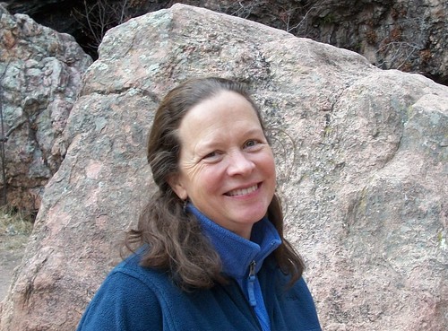
CNHP Botanist Susan Spackman Panjabi. Photo courtesy of USFWS. Source.
The U.S. Fish and Wildlife Service announced on Tuesday that CNHP Botanist Susan Spackman Panjabi will receive a 2011 Partners-in-Mission Recovery Champion award for conserving endangered and threatened Colorado plants as a member of the Colorado Rare Plants Conservation Initiative (RPCI).

Members of RPCI come from dozens of different organizations and the award is intended for all members, but Susan is one of four people to receive honorary plaques to signify the team's collective conservation accomplishments. The other three are Betsy Neely of The Nature Conservancy, Brian Kurzel of the Colorado Natural Areas Program, and Jenny Neale of the Denver Botanic Gardens.

Recovery Champions are U.S. Fish and Wildlife Service staff and their partners whose work is advancing the recovery of endangered and threatened species of plants and animals. A total of 56 teams and nine individuals were honored as 2011 Recovery Champions for work to conserve species ranging from the polar bear in Alaska, rare plants in Colorado, and the Appalachian elktoe mussel and spotfin chub in North Carolina.

Congratulations to all RPCI members and way to go, Susan!

Tuesday, March 20, 2012

Job Opening: Weed Mapping Technicians

We have seasonal job openings for up to 6 experienced field mapping technicians to map noxious weed species at the U.S. Air Force Academy and Farish Recreation Area in El Paso County, Colorado.

This position requires field botany and basic GIS skills. The successful candidates will be able to use dichotomous keys or field guides to correctly identify weed species, and have the necessary technical skills to use GPS and ESRI’s ArcPad and ArcGIS software to accurately map and attribute infestations. Field work will be performed independently, and you must provide your own transportation daily to the work location. A computer station will be provided at the Air Force Academy for daily data download and processing.

Work duration will be approximately from April through September, 2012. First consideration of applicants will begin April 2, 2012. Applications will be accepted until all positions are filled. For more information on the position and how to apply, see the full announcement on our Employment and Volunteering page.