By Laurie Gilligan, CNHP Wetland Ecologist
Last summer, CNHP’s Erick Carlson and I were a two-person team of wetland ecology buffs who spent some plant lD-filled, glorious hours sampling wetlands and riparian areas in our home river basin - the Lower South Platte River Basin. The ‘Lower’ portion of the South Platte refers to the non-mountainous section of the basin, so we surveyed many wetlands and riparian areas in northeast Colorado’s Great Plains.
We sampled two kinds of sites:
- reference examples (or the best we could find) of wetlands and riparian areas as mapped by the 1970’s National Wetlands Inventory (mapping digitized right here at CNHP by Gabrielle Smith and Erick); and
- reference examples of wetlands managed by Colorado Parks and Wildlife and other partners for wildlife habitat diversity and waterfowl use.
Although no sites selected for reference sampling were located in our home city of Fort Collins, we think the random sample of wetlands scheduled for next summer’s portion of this study just may include a few in our backyard.
So what kinds of wetlands were the best of the plains? Well, quite a variety! So enjoy the pictures, and if you like what you see, in the next couple of weeks keep your eyes peeled for our Summer 2013 wetland field technician job search posting on our website!
 |
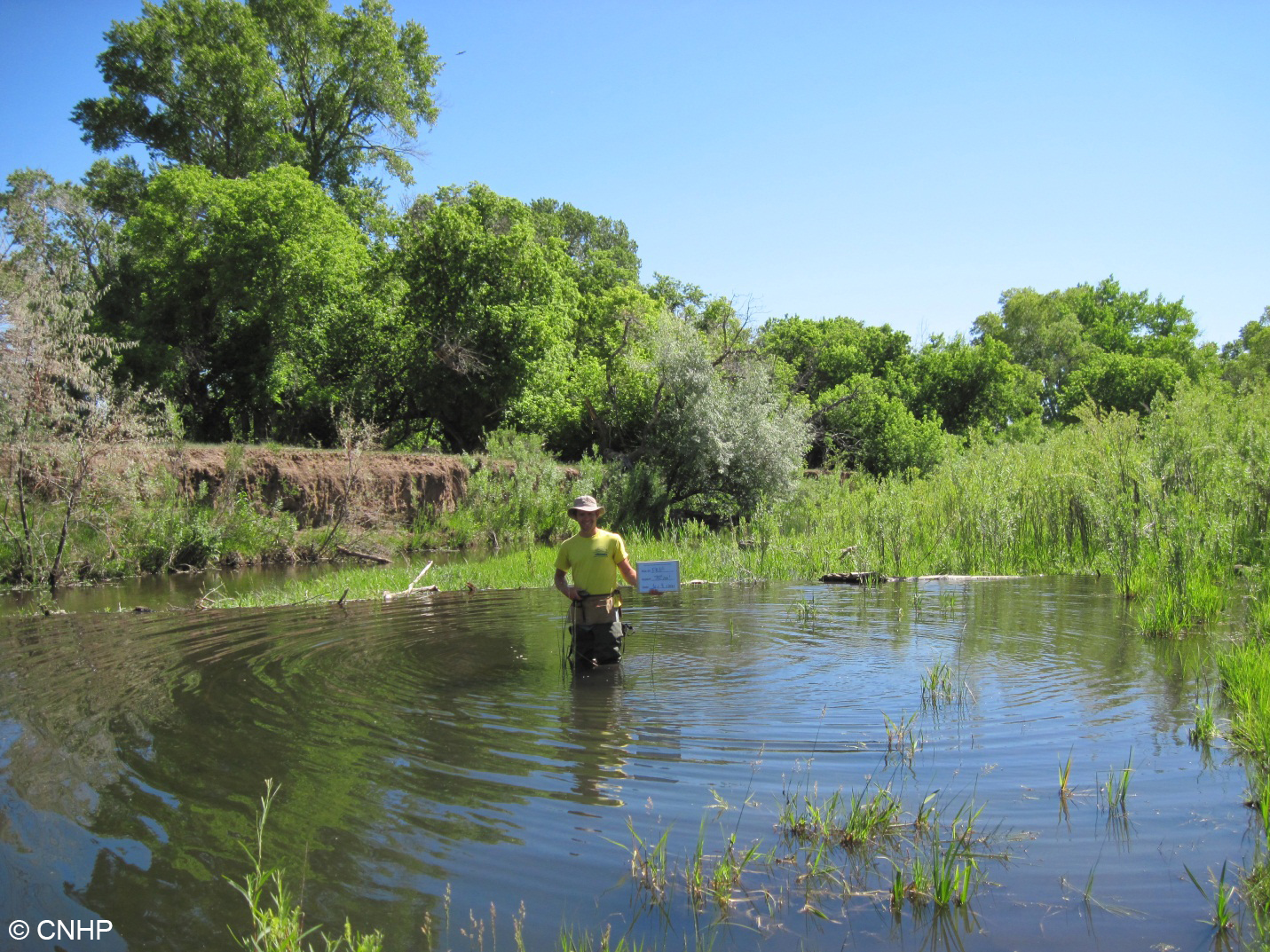
| We surveyed four woody riparian wetlands abutting the Front Range Foothills. Many riparian areas in the Front Range corridor are impacted by water diversions that reduce the rivers’ capacity to flood and sustain true riverine wetlands. This can cause incised banks as you see at this site. However, sometimes natural forces like busy beavers counter these anthropogenic impacts by creating their own flooding. This riparian shrubland wetland had high plant species diversity and nice pools due to beaver effects. |
 |
| We surveyed four sites along the main stem of the South Platte River Floodplain. They say the South Platte River used to be a mile wide and an inch deep. Maybe not so anymore, but the flat landscape and wide floodplains of the Great Plains still create excellent conditions for wildlife habitat when water levels are low and flowing. The sandbars scour and braid and are colonized by big-seeded annual grasses and forbs, making perfect habitat for migratory waterfowl food and nesting. Look at all that habitat patch diversity – that’s pretty neat-ure, eh? |
 |
| Six more sites were sampled along smaller, at times ephemeral, rivers that feed into the South Platte. Not all ‘wetlands’ mapped in NWI were actually wet - this site was sandy and dry, with an open cottonwood overstory and an understory of various native shortgrass prairie species. We were perplexed by the young cottonwoods in the wash – were they resprouts indicative of browse or grazing pressure, or did the wash flood and create a moist and open substrate suitable for new cottonwood establishment? |
 |
| We surveyed five sites mapped as herbaceous wetlands. On the ground, these ranged from open mesic meadows that would not meet the federal definition of wetlands, to classical wet meadows positioned near a break in slope and supported by high water tables, to a gorgeous fen with 80 cm of peat. This wet meadow pictured had high wildflower diversity, including a strong population of Gaura neomexicana ssp. coloradensis, which is listed as federally threatened by the Endangered Species Act. Can you spot the flowers of this plant? |
 |
We surveyed eight playas, which are shallow, depressional clay-lined wetlands that dry down for periods of time. Their shallow waters and abundant invertebrate food supply provide important habitat for migratory shorebirds in an otherwise arid portion of the western Great Plains. |
 |
| Many of the playas surveyed in their dry phase hosted hidden surprises – bird nests utilizing cow dung for shade and protection! |
 |
| We surveyed nine sites managed for wildlife habitat by Colorado Parks and Wildlife and other partners. This sandy depression is a recharge pond that floods and dries down seasonally, creating optimal conditions for an abundance of smartweed (Persicaria spp.), which are big-seeded, moist soil species tasty to waterfowl. Management of this wetland proved a huge success for waterfowl, as thousands of birds were reported to use this wetland every year. |
Though it has been ~40 years since the wetlands of the Lower South Platte basin were mapped, this project is the first of its kind to sample and understand the full range of wetland and riparian diversity across the basin. After a successful summer of surveying 35 reference sites, disturbance ecology proved to be the summer’s mantra. This made for an interesting field season. While landscapes that are less disturbed from anthropogenic effects are the most sought-after for reference sampling, it was a regime of natural disturbance (flooding, beaver activity, wet and dry cycles, etc.) that tied together many of these sites and made them the local gems that they are. Disturbance can be natural, and nature is variable…


No comments:
Post a Comment
Thanks for your comment!
Please note that all comments are moderated, so there may be a delay of some hours (especially over the weekend or at night Colorado time) before your comment shows up.