Tuesday, February 26, 2013

Mapping warm water sloughs on the South Platte

by Jeremy Sueltenfuss, CNHP Wetland Ecologist


For many years, our partners in the wildlife community have talked at length about the importance of warm water sloughs for overwintering Colorado wildlife.  As they are continually recharged by emerging groundwater, which is not subjected to the freezing temperatures at the surface, these stream-like features are some of the only water bodies across the landscape that remain open throughout the winter, providing wildlife much needed access to water during the cold winter months.  Because of their importance, we set out to map all the sloughs we could find along the South Platte River.  While aerial imagery can be quite good at mapping water features, nothing beats a low altitude flight to get a sense of the landscape!

Though familiar with the more common method of flying (being inside the plane that is), Jacqui thought she would give this method a shot.  It did not last long.  An immense thanks to Colorado Parks and Wildlife for supplying us with their plane and the CPW pilot, Brian, for a very safe and rewarding experience.  
Taking off in a small four seat prop plane from the Fort Collins – Loveland airport (Fort Love as our pilot referred to it), Jacqui, a fearless CNHP work-study student and I put our faith in our pilot, Brian.  Brian has been flying for Colorado Parksand Wildlife (CPW) for years, and his knowledge of both the landscape and local wildlife was tremendously beneficial.  Beyond his ability to spot herds of deer, gaggles of geese, and flocks of turkey from amazing distances, his stories from his work for CPW were breathtaking.  While I love hiking to remote mountain lakes, I have never thought about what it takes to stock them with fish.  Brian’s stories of maneuvering his small plane through tight mountain corridors, dropping his air speed to levels I personally never wish to feel while in flight, and releasing hundreds of small fish at precisely the right moment for them to land in the lake, all while watching the rock face in front of you fill your vision, was enough to make me sweat.  Luckily for us, the only aerial acrobatics we performed were slow broad circles to get a closer look at a slough, or a better view of some wildlife. 

Continually being recharged by groundwater, warm water sloughs remain slightly warmer than other surface waters and remain open throughout the winter.  This provides much needed access to water for wildlife in the area.
Though “Colorful Colorado” is quite brown in the winter, flying at 150 feet over the South Platte was fascinating and beautiful.  As promised, sloughs seemed to be the only open water around, and the leafless trees afforded views of the many flocks of waterbirds, small herds of deer bounding away, and even a few scenes of male turkeys doing their best to impress a nearby female.  The seven bald eagles we saw perched in trees or soaring above the river provided a wonderful example of an Endangered Species Act success story and served as tribute to the tremendous effort of conservation groups over the past 50 years.  It was enough to almost forget what we were after!  Armed with maps of sloughs we had completed before the flight using imagery from the summer, we constantly compared what was in our maps to what we were seeing on the ground.  Both Jacqui and Brian seemed to do quite well looking down at maps and back out at the landscape for 4 straight hours.  While I did my best to appear absolutely normal, my stomach was reenacting what it must feel like to stock those high mountain lakes!  Queasiness aside, we accomplished our goal and came away with a highly accurate map of the warm water sloughs along the South Platte River between Greeley and the state line.  Though many other riparian landscapes across the state contain warm water sloughs that may one day be mapped, I have high hopes this data can be used for the restoration and the conservation of lands containing these important features.     

Thursday, February 14, 2013

Updated Specimen Information on Rocky Mountain Herbarium Website


The Rocky Mountain Herbarium online database has been updated to include specimens from floristics projects in the Medicine Bow National Forest (WY side), Vermejo Park Ranch (NM), Lewis and Clark National Forest (MT) and the Comanche and Cimarron National Grasslands (CO and KS). If you want to explore the specimens and their mapped locations on Google Earth, visit the Rocky Mountain Herbarium Specimen Database.


A tiny lace hedgehog cactus (Echinocereus reichenbachii)
growing on a shale outcrop above the Purgatoire River. 

The Comanche National Grassland of SE Colorado has a unique flora that includes elements of prairie species such as purple coneflower (Echinacea angustifolia), mixed with montane/foothill species like Gambel oak (Quercus gambelii).  If you are looking for new places to explore in Colorado, this area can be a warm and sunny haven in late April and May. Bring your flora, plenty of water, and maybe even your mountain bike.

The Purgatoire River Valley dotted with oneseed juniper (Juniperus monosperma)
and mountain mahogany (Cercocarpus montanus).

Tuesday, February 12, 2013

Wanted: Wetland Ecology Field Technicians for Summer 2013 work!


The Colorado Natural Heritage Program (CNHP) at Colorado State University (CSU) seeks 4–6 experienced field technicians for summer field work assessing the condition of wetlands throughout the lower South Platte River Basin. All positions require field botany or ecology skills. Knowledge of plant taxonomy and species identification required. Preferred qualifications include experience in wetland or riparian ecology, knowledge of local flora, and familiarity performing field work for long days (10+ hours).


Fieldwork will take place in randomly selected wetlands in urban areas, agricultural areas, and more remote natural areas as part of wetland condition and wildlife habitat assessment. Standard duties will involve driving and hiking to field sites; in-field plant identification and in-office plant identification with a microscope; extensive collection of vegetation, soil, wildlife habitat, and environmental data; detailed completion of field survey forms; and landowner interactions.


For more details and to find out how to apply, read the full announcement here!

Thursday, February 7, 2013

New Report: Treeline Monitoring in the San Juan Basin Tundra


Mountain ecosystems, particularly alpine, are among the most vulnerable to climate change. Warming conditions are likely to cause trees and shrubs to encroach into alpine tundra habitats, which are home to many species found nowhere else.

CHNP, in cooperation with the Bureau of Land Management, U.S. Forest Service and Colorado College, began a pilot project to monitor treeline expansion in the San Juan mountains. A combination of fieldwork and spatial analysis was used to determine if the treeline on the southwest slope of Kendall Mountain had changed in the last 50 years.

Aerial imagery from 1951 and 2011 were used to establish transects perpendicular to the treeline to detect growth of new trees upslope, which would indicate an upward advancement of trees into alpine areas. The location of trees along these transects were then field verified, and a subset of trees were cored to determine their age. Additionally, the density of trees below the treeline was calculated for both time periods.

Recruitment above treeline
Results show that the treeline has not advanced significantly in the last 50 years. However, there are signs of upslope recruitment (trees between 20-50 years old above the current treeline, but not in sufficient density to form a new treeline). Should this area of new recruitment continue to fill in and become the new treeline, it will be 160 feet above the existing line. Additionally, tree density below the current treeline has increased by approximately 12% in the last 50 years. All tree cores taken demonstrated an increase in growth rate since 1996.

For more information, see the complete report. We hope to expand this pilot project to study more treelines throughout the San Juan mountains, to determine if these increases in growth rate and tree density are consistent trends that can be correlated with measured increases in average summer temperatures.

Wednesday, January 30, 2013

Reference Wetlands and Disturbance in the Lower South Platte River Basin

By Laurie Gilligan, CNHP Wetland Ecologist

Last summer, CNHP’s Erick Carlson and I were a two-person team of wetland ecology buffs who spent some plant lD-filled, glorious hours sampling wetlands and riparian areas in our home river basin - the Lower South Platte River Basin. The ‘Lower’ portion of the South Platte refers to the non-mountainous section of the basin, so we surveyed many wetlands and riparian areas in northeast Colorado’s Great Plains.

We sampled two kinds of sites:
  1. reference examples (or the best we could find) of wetlands and riparian areas as mapped by the 1970’s National Wetlands Inventory (mapping digitized right here at CNHP by Gabrielle Smith and Erick); and 
  2. reference examples of wetlands managed by Colorado Parks and Wildlife and other partners for wildlife habitat diversity and waterfowl use. 
Although no sites selected for reference sampling were located in our home city of Fort Collins, we think the random sample of wetlands scheduled for next summer’s portion of this study just may include a few in our backyard.


So what kinds of wetlands were the best of the plains? Well, quite a variety! So enjoy the pictures, and if you like what you see, in the next couple of weeks keep your eyes peeled for our Summer 2013 wetland field technician job search posting on our website! 

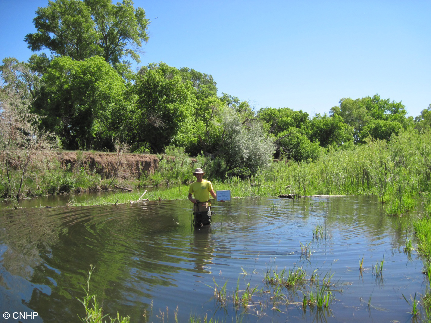
We surveyed four woody riparian wetlands abutting the Front Range Foothills. Many riparian areas in the Front Range corridor are impacted by water diversions that reduce the rivers’ capacity to flood and sustain true riverine wetlands. This can cause incised banks as you see at this site. However, sometimes natural forces like busy beavers counter these anthropogenic impacts by creating their own flooding. This riparian shrubland wetland had high plant species diversity and nice pools due to beaver effects. 

We surveyed four sites along the main stem of the South Platte River Floodplain. They say the South Platte River used to be a mile wide and an inch deep. Maybe not so anymore, but the flat landscape and wide floodplains of the Great Plains still create excellent conditions for wildlife habitat when water levels are low and flowing. The sandbars scour and braid and are colonized by big-seeded annual grasses and forbs, making perfect habitat for migratory waterfowl food and nesting. Look at all that habitat patch diversity – that’s pretty neat-ure, eh? 

Six more sites were sampled along smaller, at times ephemeral, rivers that feed into the South Platte. Not all ‘wetlands’ mapped in NWI were actually wet  - this site was sandy and dry, with an open cottonwood overstory and an understory of various native shortgrass prairie species. We were perplexed by the young cottonwoods in the wash – were they resprouts indicative of browse or grazing pressure, or did the wash flood and create a moist and open substrate suitable for new cottonwood establishment?


We surveyed five sites mapped as herbaceous wetlands. On the ground, these ranged from open mesic meadows that would not meet the federal definition of wetlands, to classical wet meadows positioned near a break in slope and supported by high water tables, to a gorgeous fen with 80 cm of peat. This wet meadow pictured had high wildflower diversity, including a strong population of Gaura neomexicana ssp. coloradensis, which is listed as federally threatened by the Endangered Species Act.  Can you spot the flowers of this plant?


We surveyed eight playas, which are shallow, depressional clay-lined wetlands that dry down for periods of time. Their shallow waters and abundant invertebrate food supply provide important habitat for migratory shorebirds in an otherwise arid portion of the western Great Plains.

Many of the playas surveyed in their dry phase hosted hidden surprises – bird nests utilizing cow dung for shade and protection!

We surveyed nine sites managed for wildlife habitat by Colorado Parks and Wildlife and other partners. This sandy depression is a recharge pond that floods and dries down seasonally, creating optimal conditions for an abundance of smartweed (Persicaria spp.), which are big-seeded, moist soil species tasty to waterfowl.  Management of this wetland proved a huge success for waterfowl, as thousands of birds were reported to use this wetland every year.

Though it has been ~40 years since the wetlands of the Lower South Platte basin were mapped, this project is the first of its kind to sample and understand the full range of wetland and riparian diversity across the basin. After a successful summer of surveying 35 reference sites, disturbance ecology proved to be the summer’s mantra. This made for an interesting field season. While landscapes that are less disturbed from anthropogenic effects are the most sought-after for reference sampling, it was a regime of natural disturbance (flooding, beaver activity, wet and dry cycles, etc.) that tied together many of these sites and made them the local gems that they are. Disturbance can be natural, and nature is variable… 

Monday, January 28, 2013

A Trip to Washington DC

by David G. Anderson

A visit to Washington DC is always interesting and inspiring, and my trip this month was no exception!  There were several reasons to go this time.  I gave two presentations on CNHP’s projects at the Transportation Research Board’s (TRB) annual Meeting.  One was on our wildlife escape ramp study, led by Jeremy Siemers, and funded by CDOT.  The other was on our pilot test of the Integrated Ecological Framework, a project funded by TRB.  

  
Participants in TRB’s annual meeting at the Washington Hilton.
This conference coincided with the Disasters and Environment Conference, held by the National Council for Science and the EnvironmentCSU is a sponsoring institution of this conference and our Dean, Joyce Berry, and our Provost Rick Miranda were there.   There were presentations by many inspiring environmental leaders (the outgoing director of NOAA, Jane Lubchenco, gave a memorable presentation). 

The beautiful Ronald Reagan Building, where the
Disasters and Environment conference was held.  
And of course, I also spent a day visiting our friends at NatureServe’s headquarters in Arlington, Virginia.  With Leslie Honey, Vice President of Conservation Services for NatureServe, I met with Dan Fenn, a staffer in Senator Mark Udall’s Office.  We showed him the State of Colorado’s Biodiversity 2011 and gave him a copy of CNHP’s High Park Fire poster, and it was a wonderful opportunity to highlight some of the ways that we can help identify no-regrets conservation solutions.  Leslie and I made a great team and I hope we can visit our congressional representatives again before long!  It was fun to visit our friends at NatureServe- thank you to everyone (Pat, Leslie, Lori, Don, Rob, Kat, and Bruce) for your hospitality. 

Two of our friends from Oregon, Jimmy Kagan (Director of the Oregon Biodiversity Information Center (ORBIC), CNHP’s analog in that state) and Lisa Gaines (Director of the Oregon Institute for Natural Resources), spent the week there as well and we did a pretty good job of trying some of Washington’s fabulous culinary offerings together while figuring out how to conserve the world's biodiversity.  Jimmy and I visited the wonderful United States Botanic Garden between meetings on the last day of my stay.  One of my favorite things there, aside from the beautiful orchid collection, was getting to see the Wollemi pine.  I had read about the discovery of this ancient tree species in the Blue Mountains of Australia 10 years ago, and it was wonderful to meet this species in person!  

Jimmy Kagan, Director of the ORBIC - a rare species indeed.

Wollemi Pines in the Rare and Endangered Species
Collection at the US Botanic Garden
On the last evening of my stay I walked down Pennsylvania Avenue back to my hotel (after stopping for a beer near the Whitehouse, where I met the City Manager of the City of Auburn, WA and a former hedge fund manager for Louis Bacon - both classic Washington DC experiences), and followed the parade route for Obama’s Inauguration.  

Pennsylvania Avenue on January 17th, just before Obama’s Inauguration
It was wonderful to showcase CNHP’s success, leadership, and conservation innovations in Washington DC with our national leaders.  I am so proud to work at a Heritage Program that has so much to offer in this regard! 


Tuesday, January 22, 2013

CNHP Completes Data Exchange with NatureServe

CNHP is a member program of NatureServe.  NatureServe has 82 member programs in Canada, the United States, Latin America, and the Caribbean. The power of the network lies in its consistent use of heritage methodology. Local data are collected and ranked in similar fashion by member programs, and as such, are scalable at national and international levels. Data exchanges between NatureServe and member programs ensure that the entire network has up-to-date information on species’ global imperilment ranks and conservation priorities.


Earth from space

In September 2012, CNHP exported and delivered data on Colorado’s rare and imperiled species to the NatureServe office in Arlington, VA. By December 2012, CNHP received the data back from NatureServe, complete with the latest international ranks and taxonomic information, and integrated the changes into Colorado’s BIOTICs database. This is likely our last data exchange. NatureServe is developing an online database which will replace the current data exchange process and provide real-time data synchronization in the future!


Map of Natural Heritage Member Programs


Thursday, January 10, 2013

New CNHP employee: Jeremy Sueltenfuss

After receiving a bachelor’s degree from Colorado College, my wife and I moved to Venezuela for two years, where we both taught at an international private school.  Teaching middle and high school science was a great way to pass on my passion for the natural world to young eager minds.  After teaching for two years, we moved back to Colorado for me to complete a Master’s degree from Colorado State University.

Jeremy Sueltenfuss and his dog Elvis
Though most of my undergraduate research focused on the response of various wildlife communities to forest management, my interest in wetlands brought me to CSU to look at the impacts of irrigation in the west on wetland ecosystems.  Agricultural diversions have severely degraded the majority of western rivers, but leaky earthen canals transporting this water over large distances create a substantial amount of wetland area across our otherwise arid landscape.  After graduating in the summer of 2012 I worked on a wetland restoration project for the National Park Service.   Historic land use at Florissant Fossil Beds had channelized a wet meadow in the area.  We filled each of the channels and restored the natural hydrologic regime within the valley.  After this great experience CNHP hired me as a wetland ecologist and GIS specialist and I couldn't be happier!